Geodaten Afrika: Unterschied zwischen den Versionen
GISWiki - Das freie Portal für Geoinformatik (GIS)
HeinzJ (Diskussion | Beiträge) |
HeinzJ (Diskussion | Beiträge) |
||
| (5 dazwischenliegende Versionen desselben Benutzers werden nicht angezeigt) | |||
| Zeile 1: | Zeile 1: | ||
| − | |||
| − | |||
| − | |||
==Afrika== | ==Afrika== | ||
| − | * [[ | + | * http://www.maplibrary.org/ |
| + | |||
| + | * Africa [[Landsat 742]] | ||
| + | **[http://www.earthetc.com/ecwp/ecw_img.dll?thumbnail?ecw=/images/geodetic/Africa/landsat742.ecw&sizey=800&sizex=800&quality=75 Thumbnail] | ||
** [http://www.geotorrent.org/torrents/47.torrent Torrent-Download], 6.14 GB | ** [http://www.geotorrent.org/torrents/47.torrent Torrent-Download], 6.14 GB | ||
| + | |||
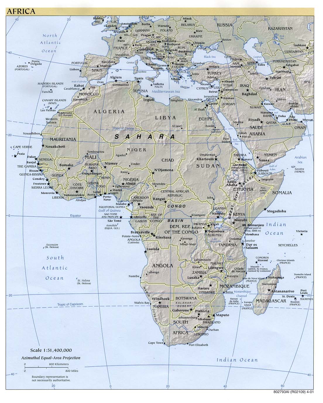
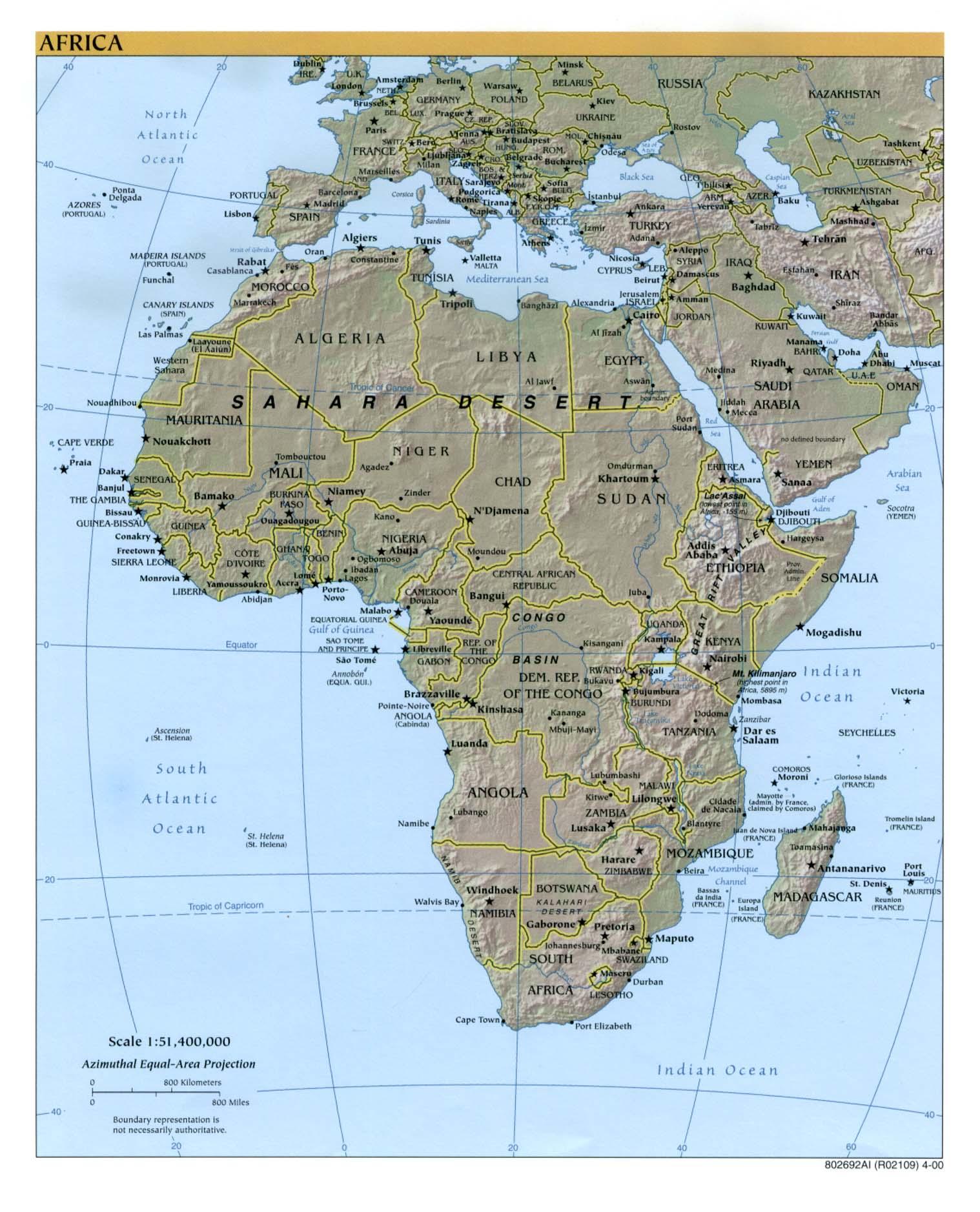
| + | * [http://www.lib.utexas.edu/maps/africa/africa_pol_2003.jpg Africa] (Political) 2003 (302K) and * [http://www.lib.utexas.edu/maps/africa/africa_pol_2003.pdf pdf format] (272K) | ||
| + | * [http://www.lib.utexas.edu/maps/africa/africa_pol01.jpg Africa] (Political) 2001 (232K) and [africa/africa_pol_2001.pdf pdf format] (234K) | ||
| + | * [http://www.lib.utexas.edu/maps/africa/africa_pol00.jpg Africa] (Political) 2000 (249K) and [africa/africa_pol_2000.pdf pdf format] (257K) | ||
| + | * [http://www.lib.utexas.edu/maps/africa/africa_pol98.jpg Africa] (Political) 1998 (452K) and [africa/africa_pol_1998.pdf pdf format] (390K) | ||
| + | * [http://www.lib.utexas.edu/maps/africa/africa_6_97.jpg Africa] (Political) June 1997 (349K) and [africa/africa_pol_1997.pdf pdf format] (338K) | ||
| + | * [http://www.lib.utexas.edu/maps/africa/africa_pol97.jpg Africa] (Political) January 1997 (366K) and [africa/africa_pol97.pdf pdf format] (1.2MB) | ||
| + | * [http://www.lib.utexas.edu/maps/africa/africa_pol95.jpg Africa] (Political) 1995 (265K) and [africa/africa_pol_1995.pdf pdf format] (262K) | ||
| + | * [http://www.lib.utexas.edu/maps/africa/africa_pol_1993.gif Africa] (Political) 1993 (274K) and [africa/africa_pol_1993.pdf pdf format] (282K) | ||
| + | * [http://www.lib.utexas.edu/maps/africa/africa_ref_2005.pdf Africa] (Reference Map) 2005 (472K) [pdf format] | ||
| + | * [http://www.lib.utexas.edu/maps/africa/africa_ref_2003.jpg Africa] (Reference Map) 2003 (392K) and [africa/africa_ref_2003.pdf pdf format] (459K) | ||
| + | * [http://www.lib.utexas.edu/maps/africa/africa_ref02.jpg Africa] (Reference Map) 2002 (320K) and [africa/africa_ref02.pdf pdf format] (323K) | ||
| + | * [http://www.lib.utexas.edu/maps/africa/africa_ref01.jpg Africa] (Reference Map) 2001 (281K) and [africa/africa_ref01.pdf pdf format] (956K) | ||
| + | * [http://www.lib.utexas.edu/maps/africa/africa_ref_2000.jpg Africa] (Reference Map) 2000 (316K) and [africa/africa_ref00.pdf pdf format] (788K) | ||
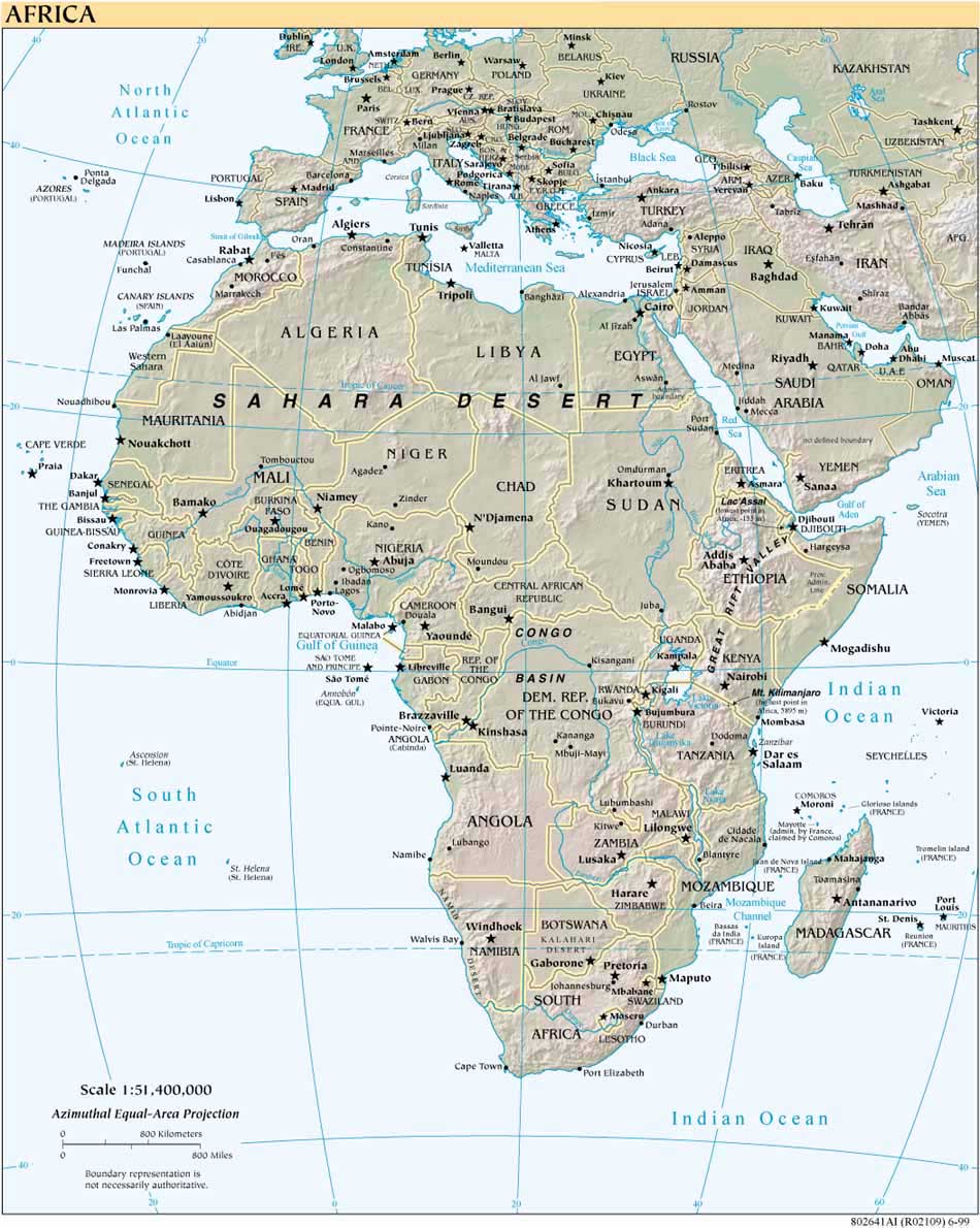
| + | * [http://www.lib.utexas.edu/maps/africa/africa_ref802641_1999.jpg Africa] (Reference Map) 1999 (190K) [africa/africa_ref802641_99.jpg larger jpeg image] (306K) and [africa/africa_ref802641_1999.pdf pdf format] (582K) | ||
| + | * [http://www.lib.utexas.edu/maps/historical/history_africa.html Africa Historical Maps] | ||
| + | * [http://www.lib.utexas.edu/maps/africa/africa_islam_87.jpg Africa, Islam in] 1987 (195K) and [africa/africa_islam_1987.pdf pdf format] (198K) | ||
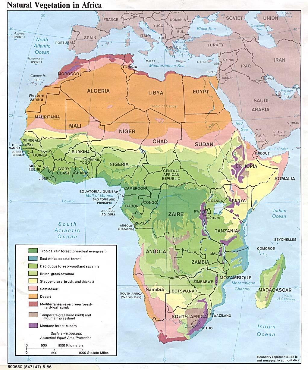
| + | * [http://www.lib.utexas.edu/maps/africa/africa_veg_86.jpg Africa Natural Vegetation] 1986 (260K) and [africa/africa_veg_1986.pdf pdf format] (234K) | ||
| + | * [http://www.lib.utexas.edu/maps/africa/africa_pop_79.jpg Africa Population Density] 1979 (232K) and [africa/africa_pop_1979.pdf pdf format] (235K) | ||
| + | * [http://www.lib.utexas.edu/maps/algeria.html Algeria Maps] | ||
| + | * [http://www.lib.utexas.edu/maps/angola.html Angola Maps] | ||
| + | * [http://www.lib.utexas.edu/maps/benin.html Benin Maps] | ||
| + | * [http://www.lib.utexas.edu/maps/botswana.html Botswana Maps] | ||
| + | * [http://www.lib.utexas.edu/maps/burkina_faso.html Burkina Faso Maps] | ||
| + | * [http://www.lib.utexas.edu/maps/burundi.html Burundi Maps] | ||
| + | * [http://www.lib.utexas.edu/maps/cameroon.html Cameroon Maps] | ||
| + | * [http://www.lib.utexas.edu/maps/cape_verde.html Cape Verde Maps] | ||
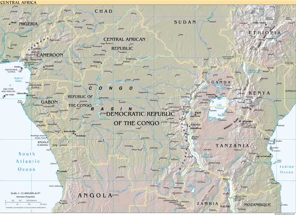
| + | * [http://www.lib.utexas.edu/maps/africa/cen_africa_ref802642_1999.jpg Central Africa] (Reference Map) 1999 (113K) [africa/africa_cen_ref802642_99.jpg larger jpeg image] (510K) | ||
| + | * [http://www.lib.utexas.edu/maps/africa/central_africa_ref01.jpg Central Africa] (Reference Map) 2001 (423K) and [africa/centralafrica_ref01.pdf pdf format] (1.4MB) | ||
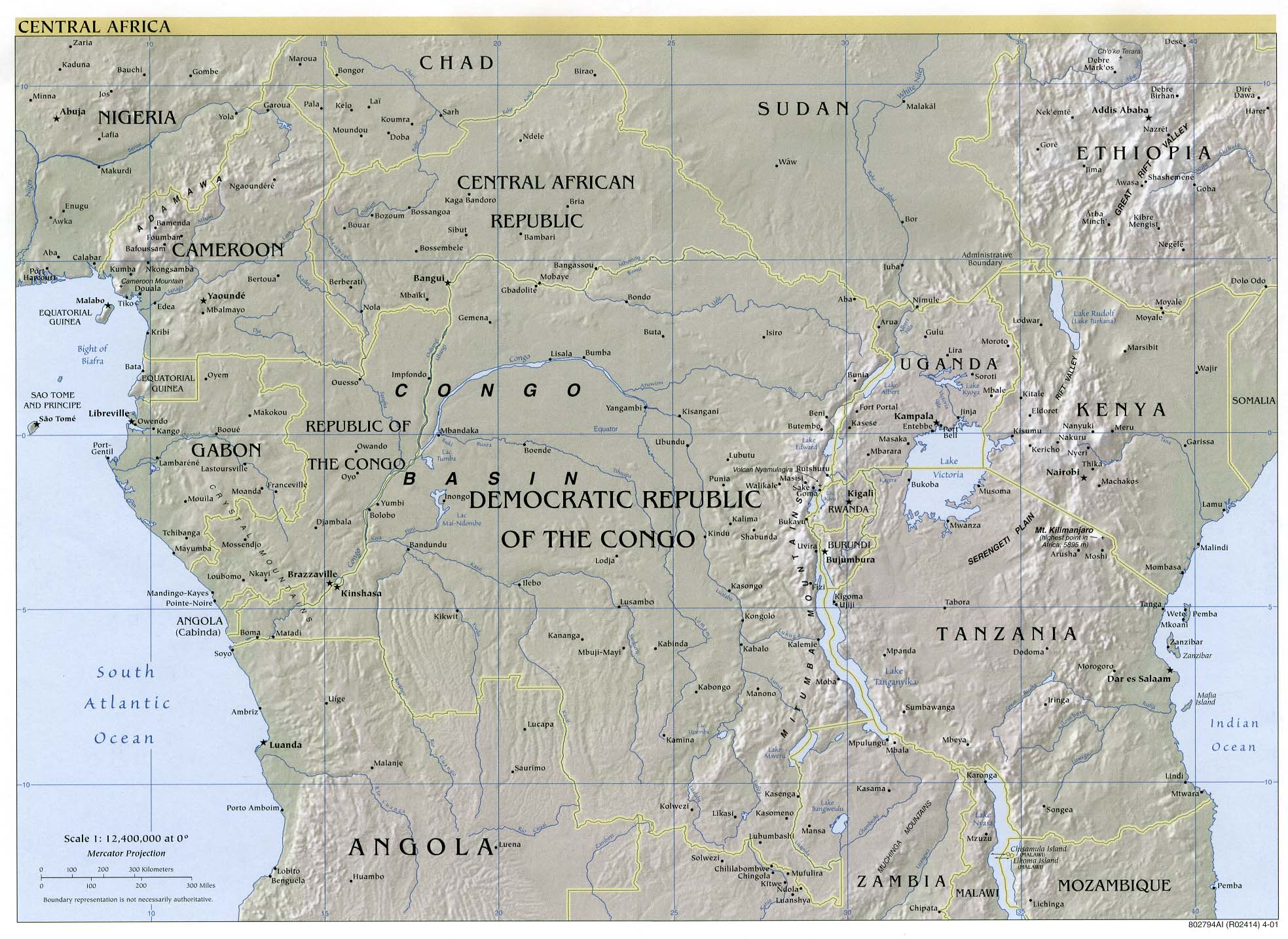
| + | * [http://www.lib.utexas.edu/maps/africa/centralafrica_ref00.pdf Central Africa] (Reference Map) 2000 (845K) [pdf format] | ||
| + | * [http://www.lib.utexas.edu/maps/africa/cen_africa_ref802642_1999.pdf Central Africa] (Reference Map) 1999 (630K) [pdf format] | ||
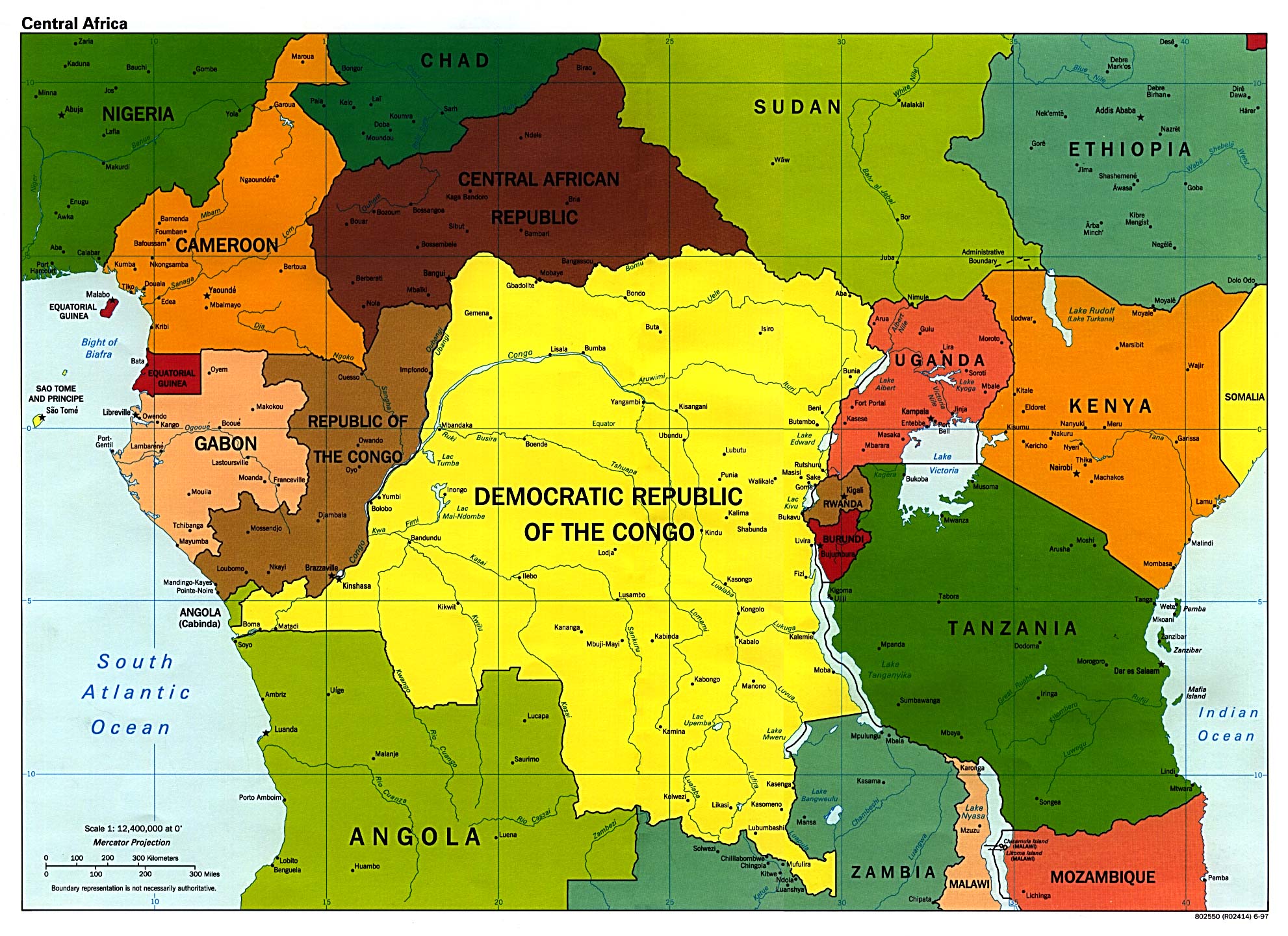
| + | * [http://www.lib.utexas.edu/maps/africa/central_africa_pol_97.jpg Central Africa] (Political) 1997 (527K) | ||
| + | * [http://www.lib.utexas.edu/maps/central_african_republic.html Central African Republic Maps] | ||
| + | * [http://www.lib.utexas.edu/maps/chad.html Chad Maps] | ||
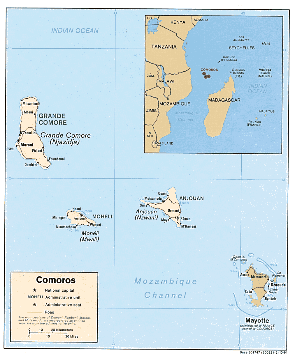
| + | * [http://www.lib.utexas.edu/maps/africa/comoros.gif Comoros] (Political) 1991 (212K) and [africa/comoros_pol_1991.pdf pdf format] (224K) | ||
| + | * [http://www.lib.utexas.edu/maps/africa/comoros_rel91.jpg Comoros] (Shaded Relief) 1991 (119K) and [africa/comoros_rel_1991.pdf pdf format] (126K) | ||
| + | * [http://www.lib.utexas.edu/maps/cia05/comoros_sm05.gif Comoros] (Small Map) 2005 (7K) | ||
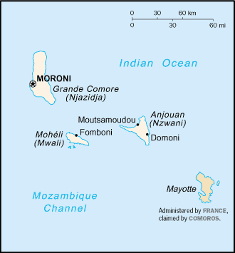
| + | * [http://www.lib.utexas.edu/maps/islands_oceans_poles/comoros_76.jpg Comoros (Grande Comore, Anjouan, Moheli, Mayotte)] From The Indian Ocean Atlas, 1976 (198K) | ||
| + | * [http://www.lib.utexas.edu/maps/zaire.html Congo Maps, Democratic Republic of the (former Zaire)] | ||
| + | * [http://www.lib.utexas.edu/maps/africa/congo.gif Congo, Republic of the] (Political) 1990 (310K) and [africa/congo_pol_1990.pdf pdf format] (337K) | ||
| + | * [http://www.lib.utexas.edu/maps/africa/congo_rel90.jpg Congo, Republic of the] (Shaded Relief) 1990 (265K) and [africa/congo_rel_1990.pdf pdf format] (274K) | ||
| + | * [http://www.lib.utexas.edu/maps/cia05/congo_republic_sm05.gif Congo, Republic of the] (Small Map) 2005 (13K) | ||
| + | * [http://www.lib.utexas.edu/maps/cote_d%27ivoire.html Cote d'Ivoire Maps] | ||
| + | * [http://www.lib.utexas.edu/maps/africa/dar_corridor_88.jpg Dar es Salaam Transport Corridor] 1988 (402K) | ||
| + | * [http://www.lib.utexas.edu/maps/djibouti.html Djibouti Maps] | ||
| + | * [http://www.lib.utexas.edu/maps/egypt.html Egypt Maps] | ||
| + | * [http://www.lib.utexas.edu/maps/equatorial_guinea.html Equatorial Guinea Maps] | ||
| + | * [http://www.lib.utexas.edu/maps/eritrea.html Eritrea Maps] | ||
| + | * [http://www.lib.utexas.edu/maps/ethiopia.html Ethiopia Maps] | ||
| + | * [http://www.lib.utexas.edu/maps/gabon.html Gabon Maps] | ||
| + | * [http://www.lib.utexas.edu/maps/gambia.html Gambia Maps] | ||
| + | * [http://www.lib.utexas.edu/maps/ghana.html Ghana Maps] | ||
| + | * [http://www.lib.utexas.edu/maps/guinea.html Guinea Maps] | ||
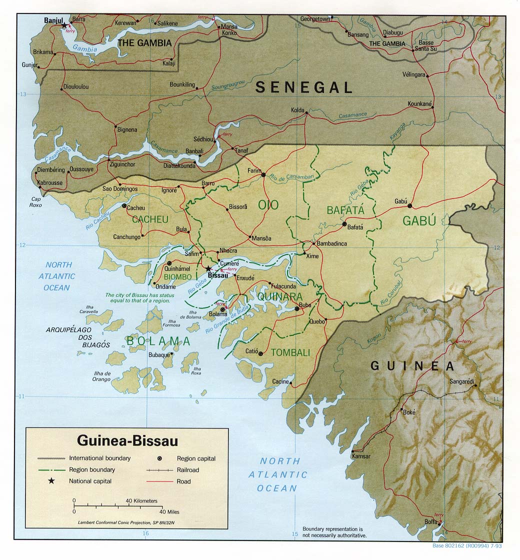
| + | * [http://www.lib.utexas.edu/maps/africa/guinea_bissau.gif Guinea Bissau] (Political) 1993 (220K) and [africa/guinea_bissau_pol_1993.pdf pdf format] (235K) | ||
| + | * [http://www.lib.utexas.edu/maps/africa/guinea_bissau_rel93.jpg Guinea Bissau] (Shaded Relief) 1993 (229K) and [africa/guinea_bissau_rel_1993.pdf pdf format] (236K) | ||
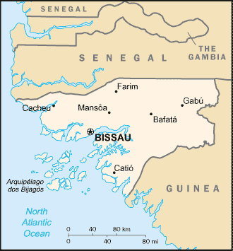
| + | * [http://www.lib.utexas.edu/maps/cia05/guinea_bissau_sm05.gif Guinea Bissau] (Small Map) 2005 (12K) | ||
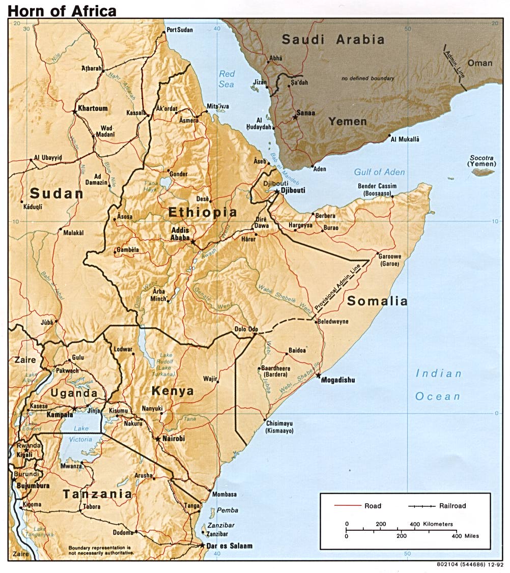
| + | * [http://www.lib.utexas.edu/maps/africa/horn_of_africa.jpg Horn of Africa] (Shaded Relief) 1992 (218K) | ||
| + | * [http://www.lib.utexas.edu/maps/africa/horn_of_africa_rel_1972.jpg Horn of Africa] (Shaded Relief) 1972 (420K) | ||
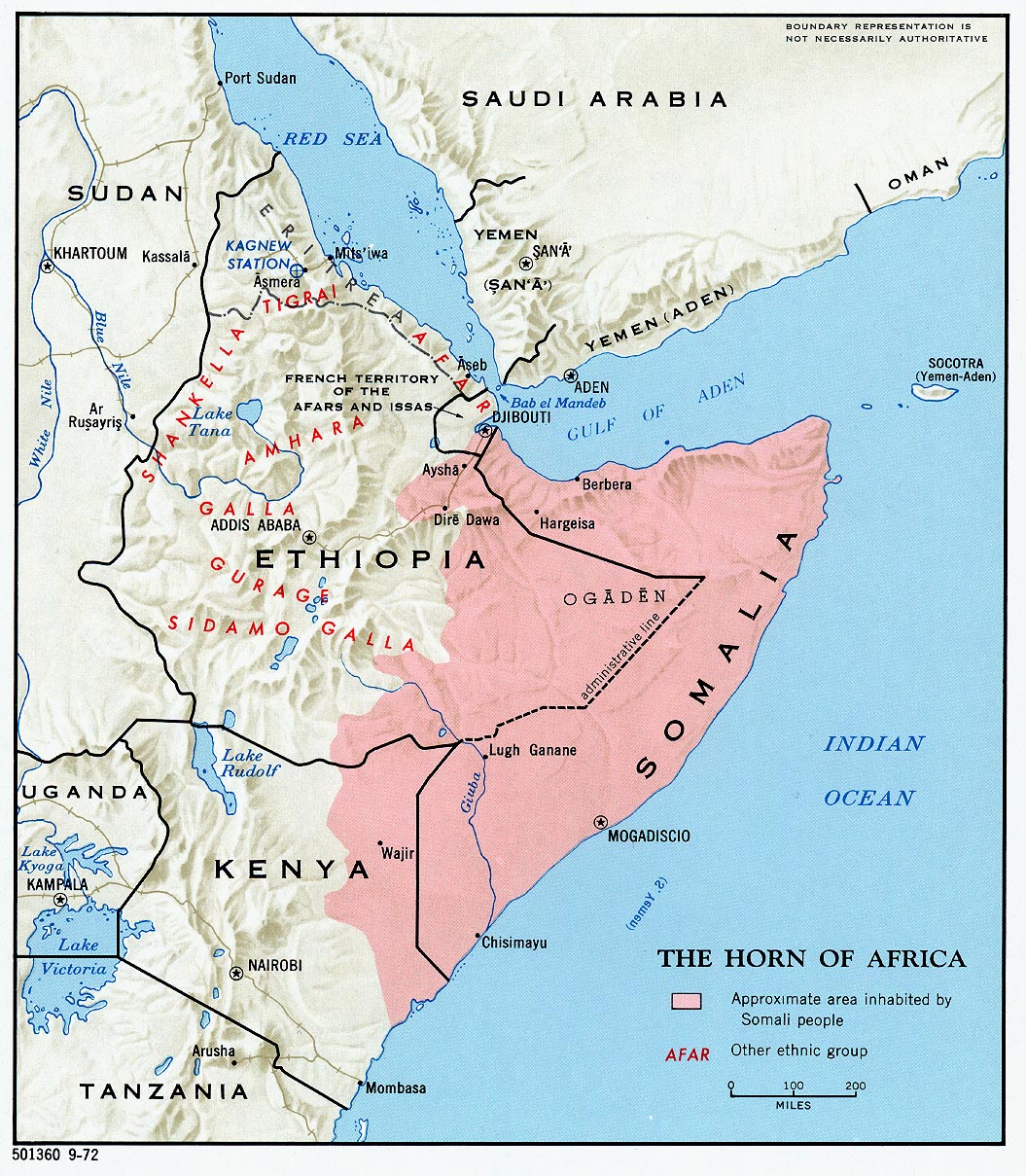
| + | * [http://www.lib.utexas.edu/maps/africa/horn_ethnic_80.jpg Horn of Africa Ethnic Groups] 1980 (213K) | ||
| + | * [http://www.lib.utexas.edu/maps/cote_d%27ivoire.html Ivory Coast (Cote d'Ivoire) Maps] | ||
| + | * [http://www.lib.utexas.edu/maps/kenya.html Kenya Maps] | ||
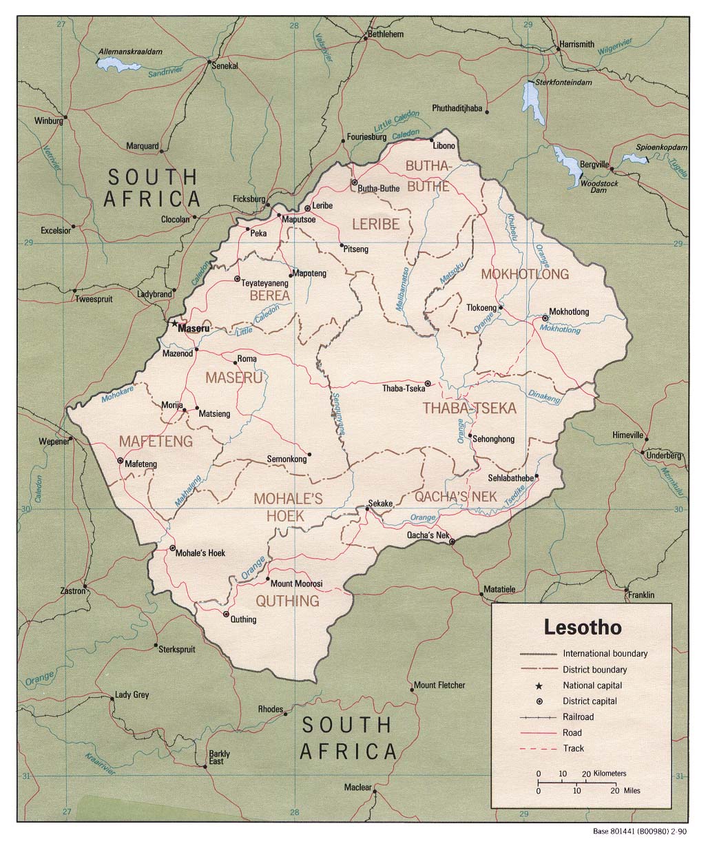
| + | * [http://www.lib.utexas.edu/maps/africa/lesotho_pol90.jpg Lesotho] (Political) 1990 (341K) and [africa/lesotho_pol90.pdf pdf format] (244K) | ||
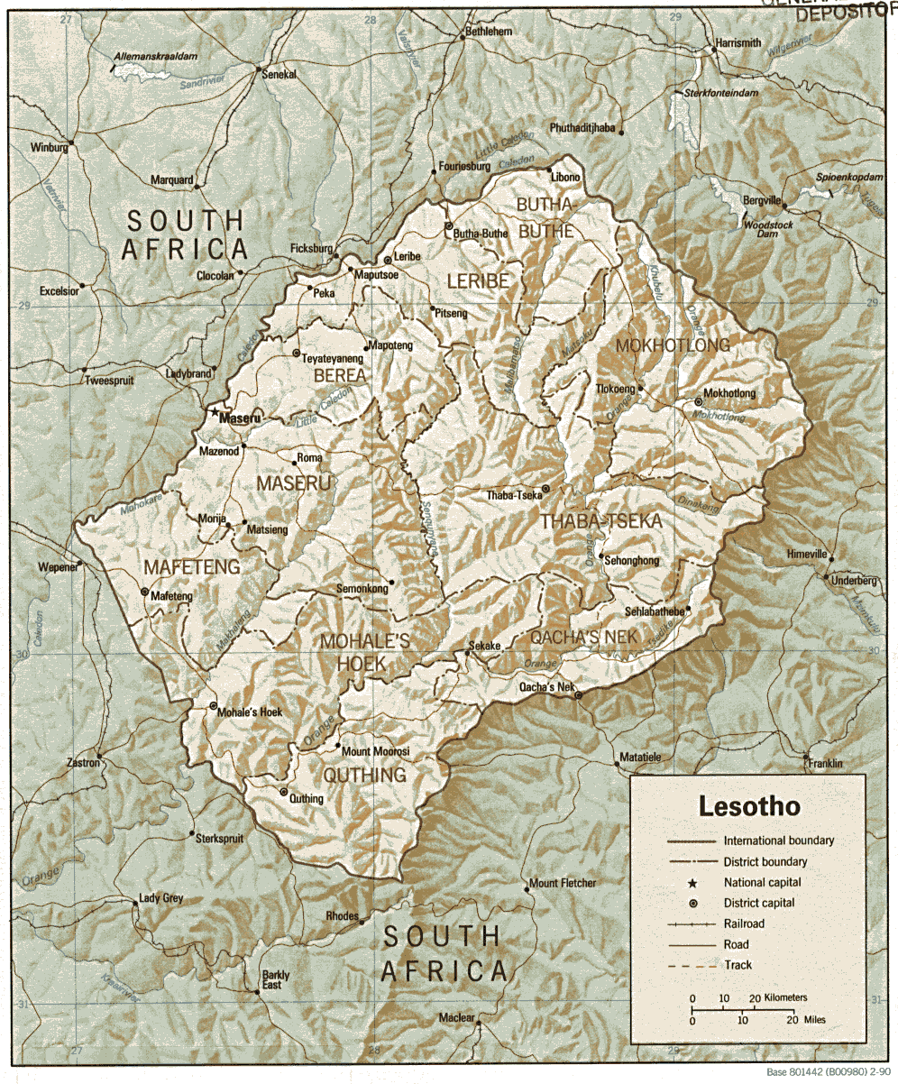
| + | * [http://www.lib.utexas.edu/maps/africa/lesotho.gif Lesotho] (Shaded Relief) 1990 (341K) and [africa/lesotho.pdf pdf format] (356K) | ||
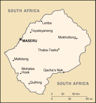
| + | * [http://www.lib.utexas.edu/maps/cia05/lesotho_sm05.gif Lesotho] (Small Map) 2005 (7K) | ||
| + | * [http://www.lib.utexas.edu/maps/liberia.html Liberia Maps] | ||
| + | * [http://www.lib.utexas.edu/maps/libya.html Libya Maps] | ||
| + | * [http://www.lib.utexas.edu/maps/madagascar.html Madagascar Maps] | ||
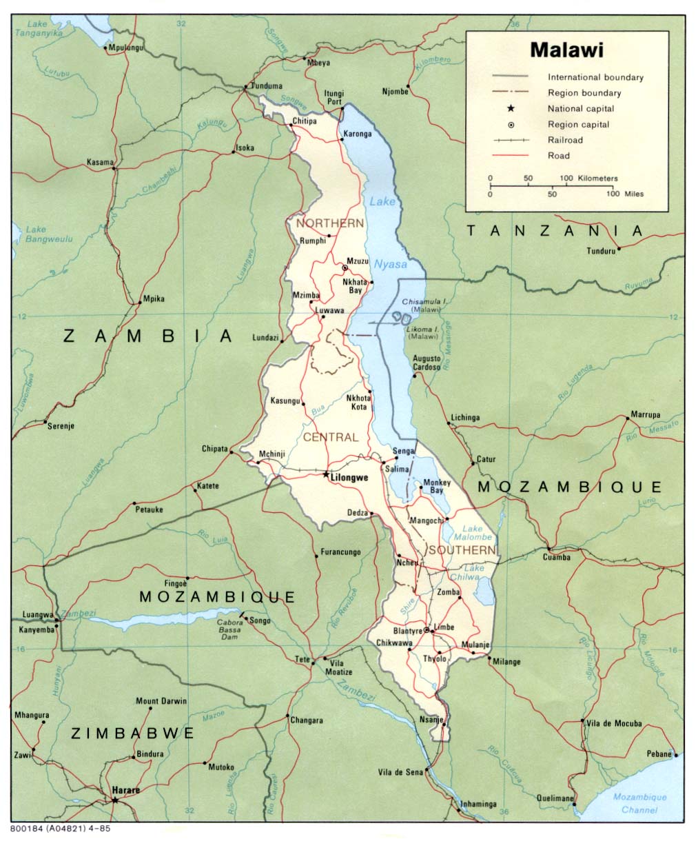
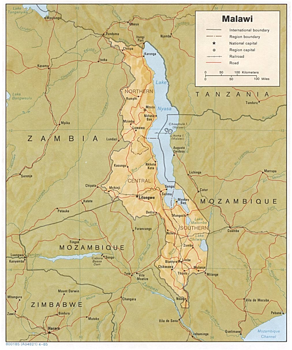
| + | * [http://www.lib.utexas.edu/maps/africa/malawi_pol85.jpg Malawi] (Political) 1985 (172K) and [africa/malawi_pol_1985.pdf pdf format] (178K) | ||
| + | * [http://www.lib.utexas.edu/maps/africa/malawi.jpg Malawi] (Shaded Relief) 1985 (197K) and [africa/malawi_rel_1985.pdf pdf format] (200K) | ||
| + | * [http://www.lib.utexas.edu/maps/cia05/malawi_sm05.gif Malawi] (Small Map) 2005 (19K) | ||
| + | * [http://www.lib.utexas.edu/maps/mali.html Mali Maps] | ||
| + | * [http://www.lib.utexas.edu/maps/mauritania.html Mauritania Maps] | ||
| + | * [http://www.lib.utexas.edu/maps/mauritius.html Mauritius Maps] | ||
| + | * [http://www.lib.utexas.edu/maps/morocco.html Morocco Maps] | ||
| + | * [http://www.lib.utexas.edu/maps/mozambique.html Mozambique Maps] | ||
| + | * [http://www.lib.utexas.edu/maps/namibia.html Namibia Maps] | ||
| + | * [http://www.lib.utexas.edu/maps/niger.html Niger Maps] | ||
| + | * [http://www.lib.utexas.edu/maps/nigeria.html Nigeria Maps] | ||
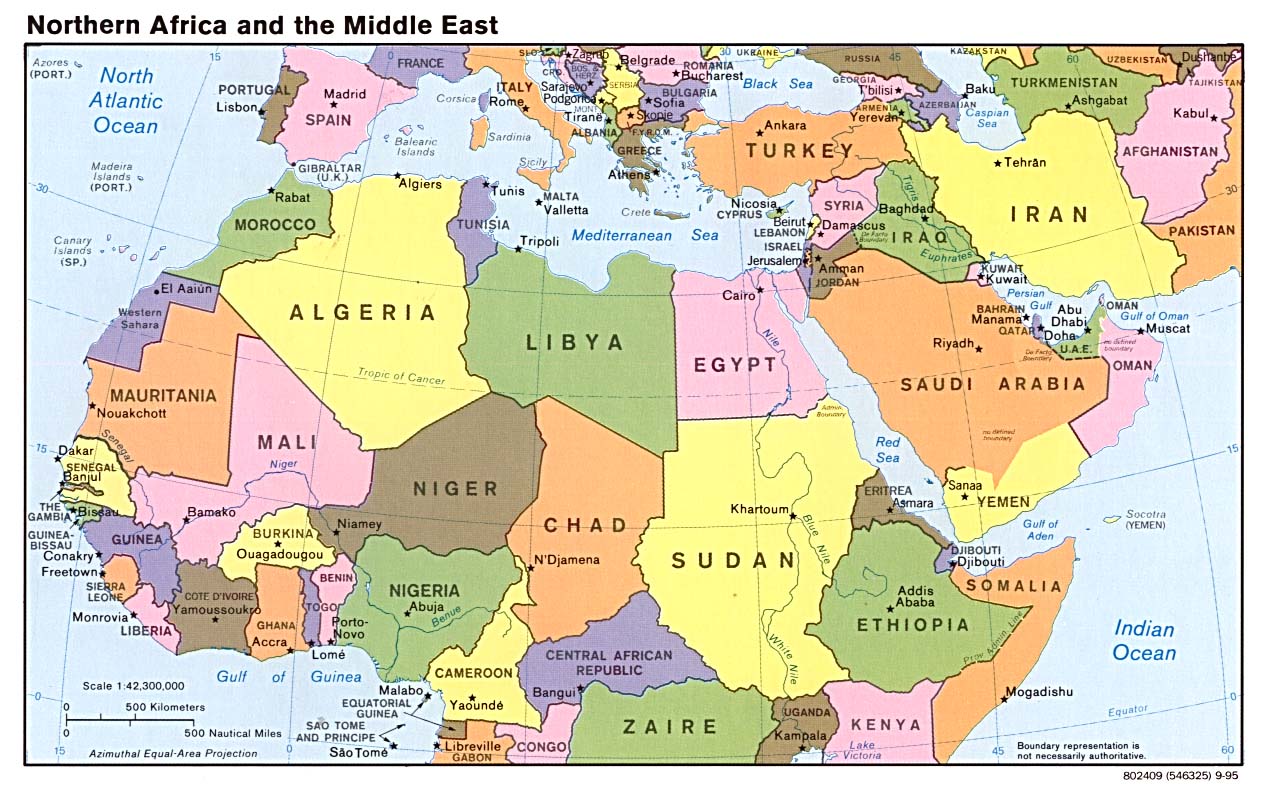
| + | * [http://www.lib.utexas.edu/maps/middle_east_and_asia/n_africa_mid_east_pol_95.jpg Northern Africa and the Middle East] (Political) 1995 (207K) | ||
| + | * [http://www.lib.utexas.edu/maps/cia05/rwanda_sm05.gif Rwanda] (Small Map) 2005 (11K) | ||
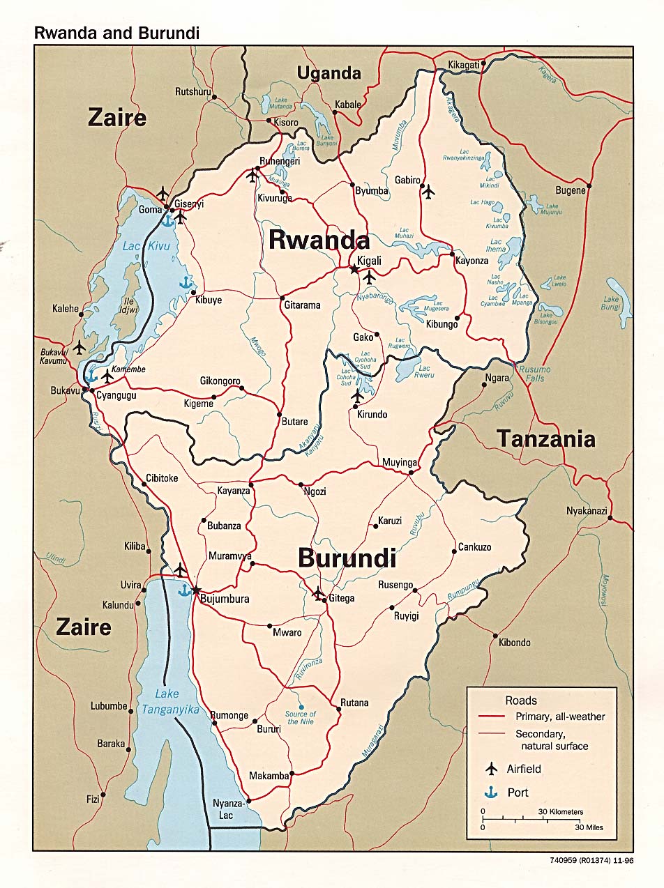
| + | * [http://www.lib.utexas.edu/maps/africa/rwanda_pol96.jpg Rwanda and Burundi] (Political) 1996 (254K) and [africa/rwanda_pol_1996.pdf pdf format] (238K) | ||
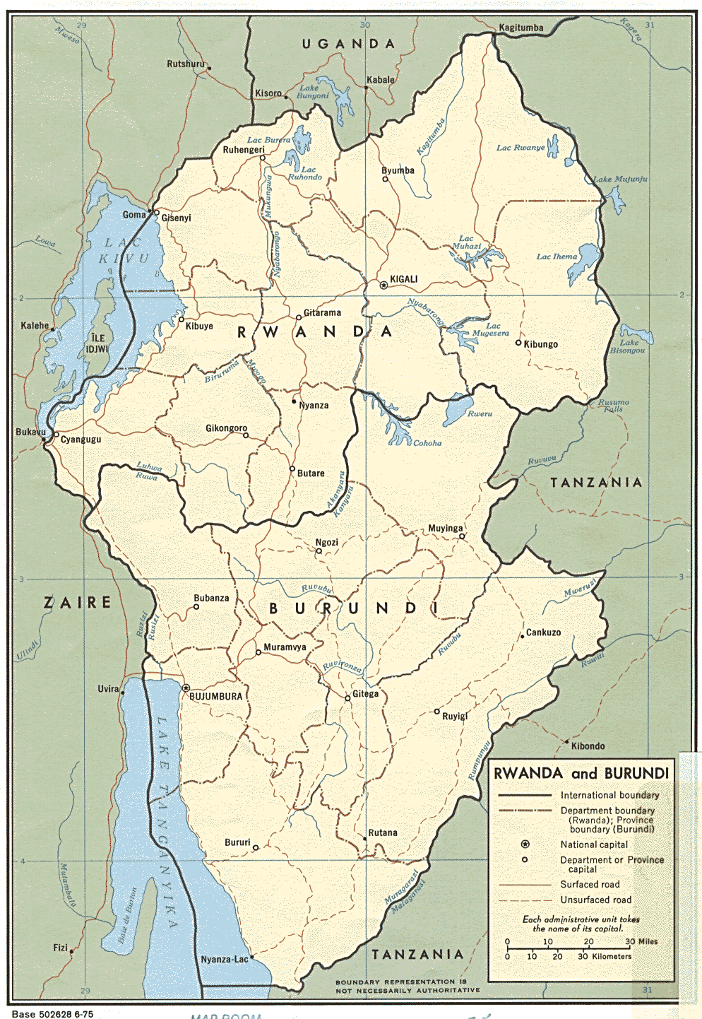
| + | * [http://www.lib.utexas.edu/maps/africa/rwanda_and_burundi.gif Rwanda and Burundi] (Political) 1975 (311K) and [africa/rwanda_and_burundi_pol_1975.pdf pdf format] (343K) | ||
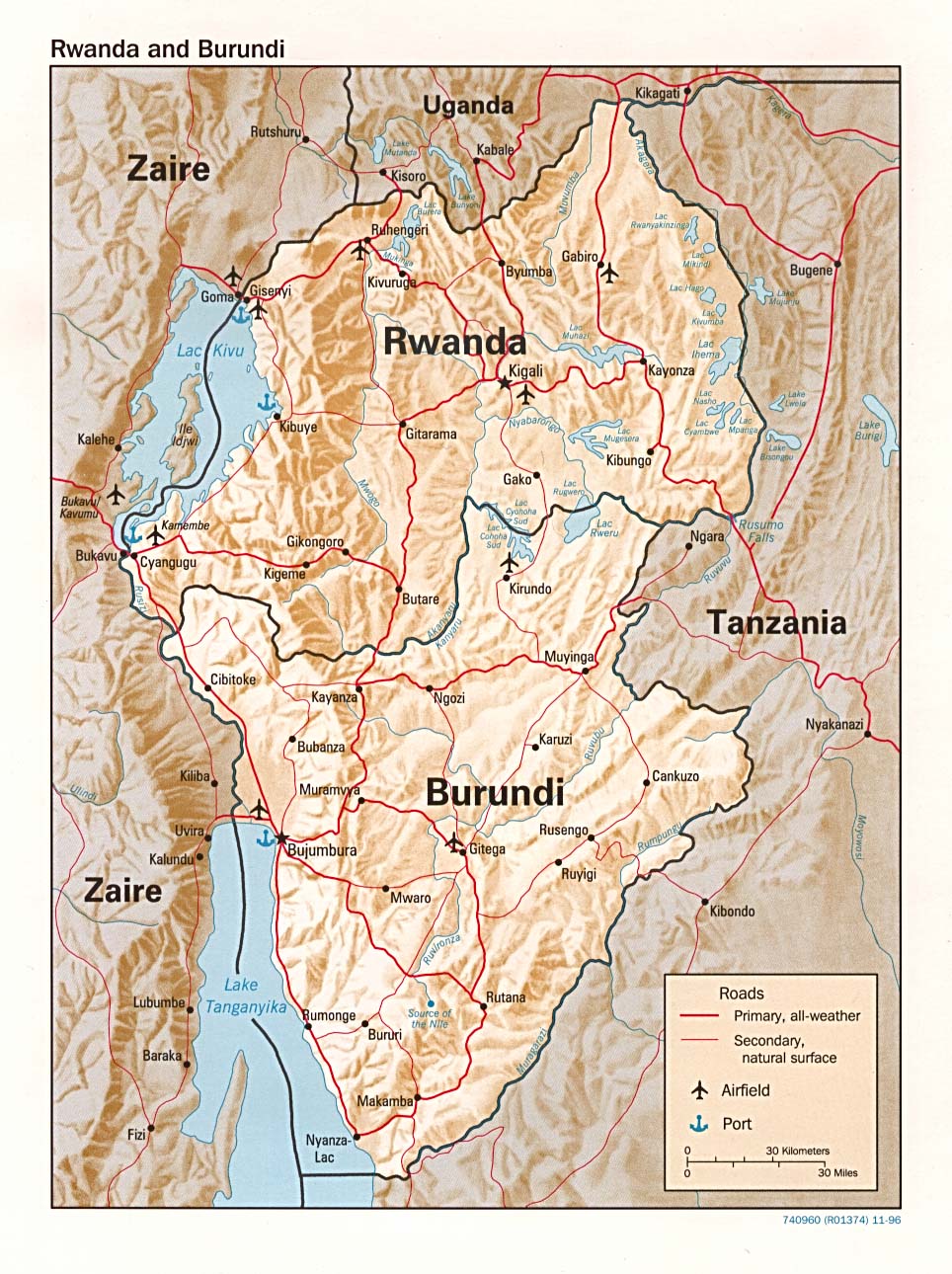
| + | * [http://www.lib.utexas.edu/maps/africa/rwanda_rel96.jpg Rwanda and Burundi] (Shaded Relief) 1996 (293K) and [africa/rwanda_rel_1996.pdf pdf format] (271K) | ||
| + | * [http://www.lib.utexas.edu/maps/africa/rwanda_burundi_rel_1975.jpg Rwanda and Burundi] (Shaded Relief) 1975 (288K) | ||
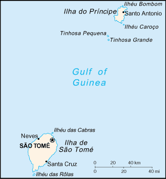
| + | * [http://www.lib.utexas.edu/maps//maps/africa/sao_tome_1963.jpg Sao Tome] Portion of Libreville sheet. Topographic Map NA 32, Series 1301.Original Scale 1: 1,000,000. Printed by U.S. Army Map Service, Corps of Engineers, 1963 (81K) | ||
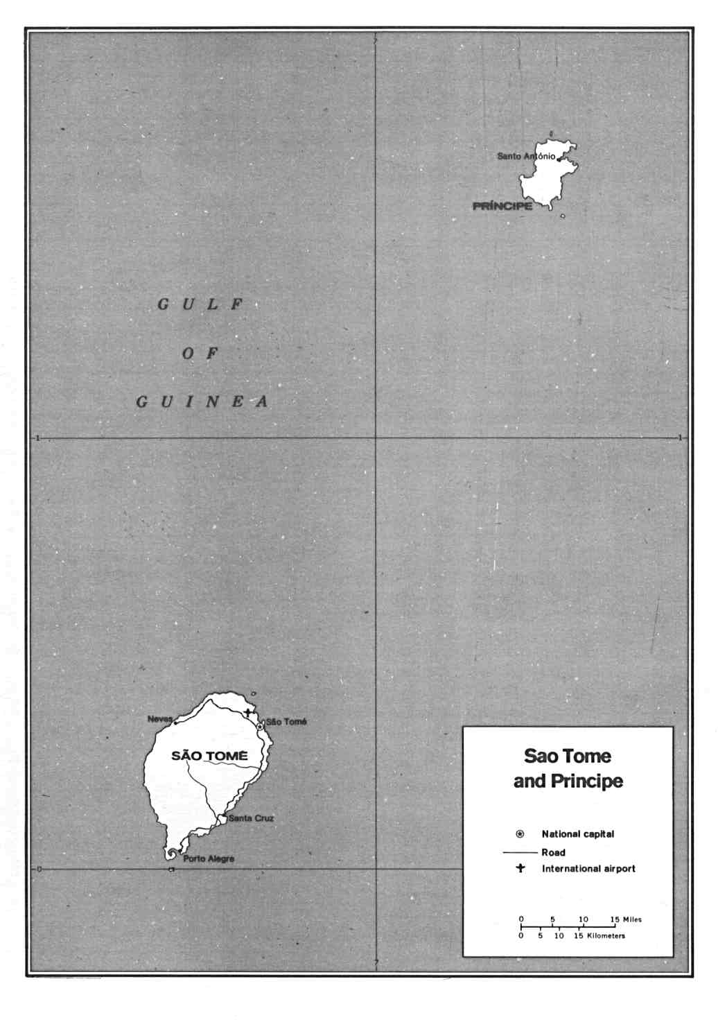
| + | * [http://www.lib.utexas.edu/maps/africa/saotomeprincipe.jpg Sao Tome and Principe] (Political) U.S. Department of State 1991 (71K) | ||
| + | * [http://www.lib.utexas.edu/maps/cia05/sao_tome_principe_sm05.gif Sao Tome and Principe] (Small Map) 2005 (6K) | ||
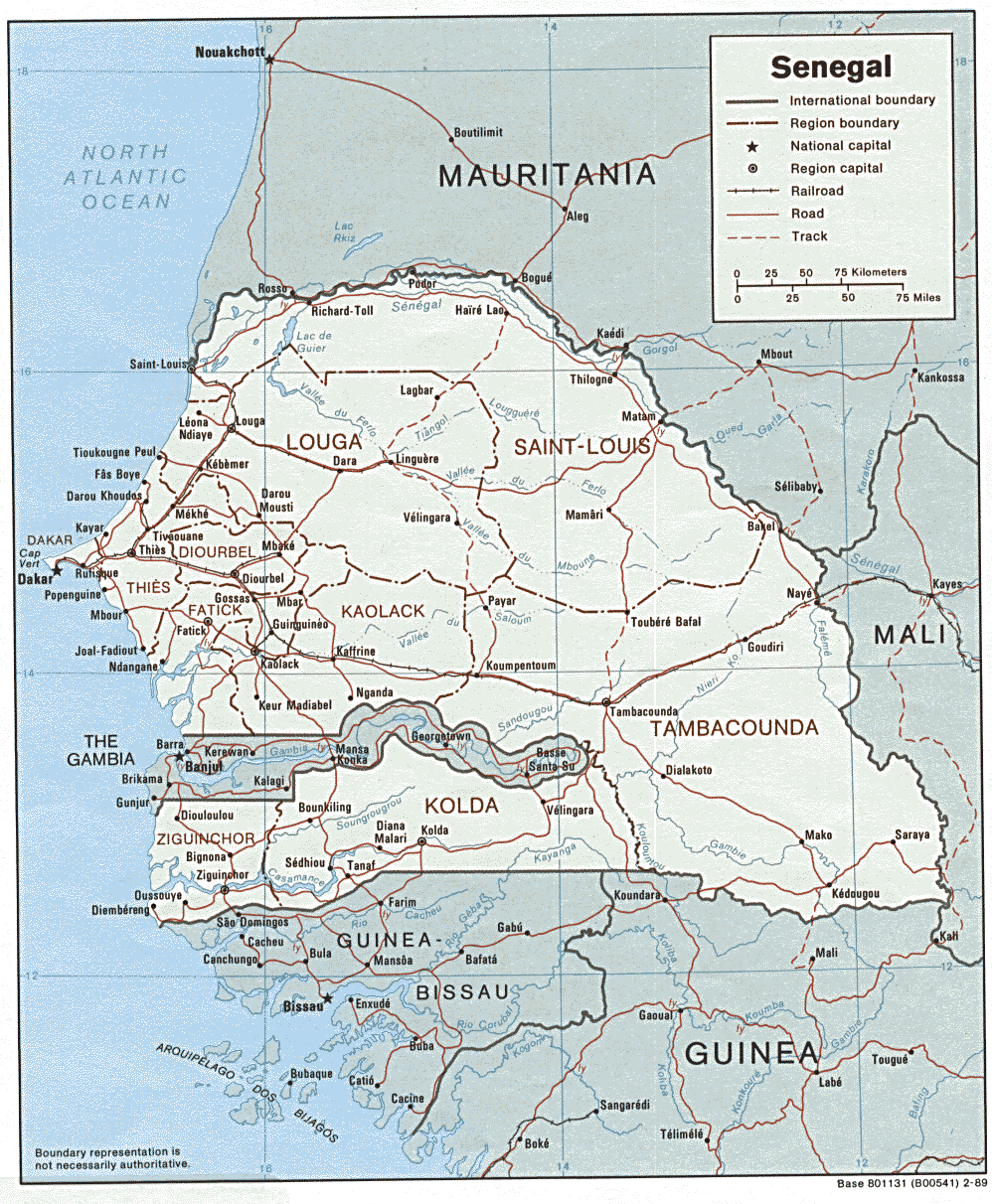
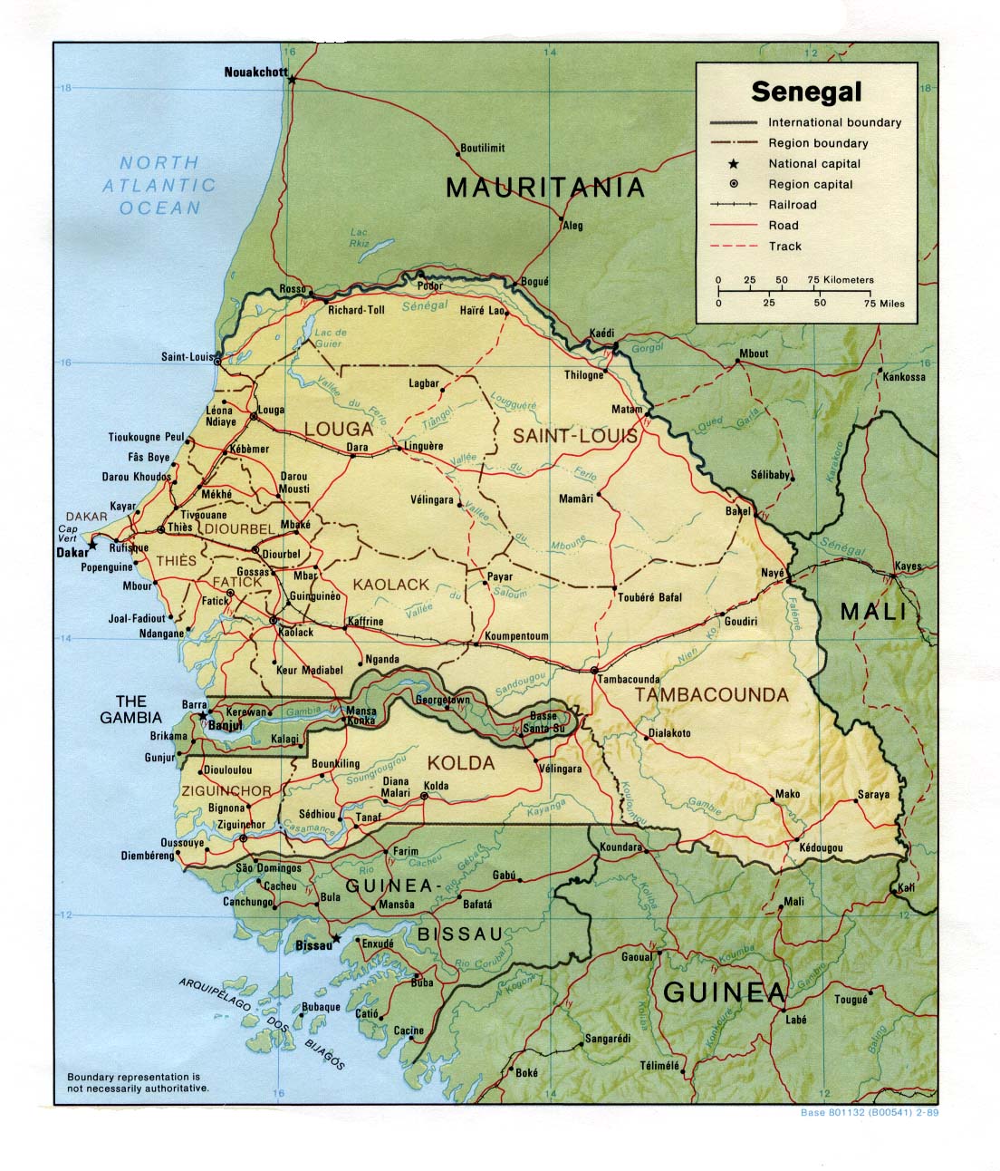
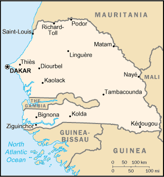
| + | * [http://www.lib.utexas.edu/maps/africa/senegal.gif Senegal] (Political) 1989 (289K) and [africa/senegal_pol_1989.pdf pdf format] (305K) | ||
| + | * [http://www.lib.utexas.edu/maps/africa/senegal_rel89.jpg Senegal] (Shaded Relief) 1989 (264K) and [africa/senegal_rel_1989.pdf pdf format] (272K) | ||
| + | * [http://www.lib.utexas.edu/maps/cia05/senegal_sm05.gif Senegal] (Small Map) 2005 (12K) | ||
| + | * [http://www.lib.utexas.edu/maps/seychelles.html Seychelles Maps] | ||
| + | * [http://www.lib.utexas.edu/maps/sierra_leone.html Sierra Leone Maps] | ||
| + | * [http://www.lib.utexas.edu/maps/somalia.html Somalia Maps] | ||
| + | * [http://www.lib.utexas.edu/maps/south_africa.html South Africa Maps] | ||
| + | * [http://www.lib.utexas.edu/maps/sudan.html Sudan Maps] | ||
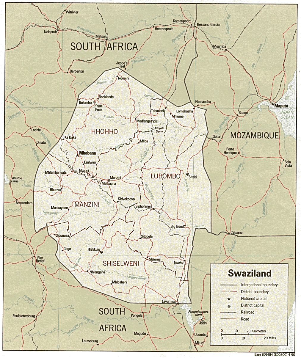
| + | * [http://www.lib.utexas.edu/maps/africa/swaziland.gif Swaziland] (Political) 1990 (327K) and [africa/swaziland_pol_1990.pdf pdf format] (346K) | ||
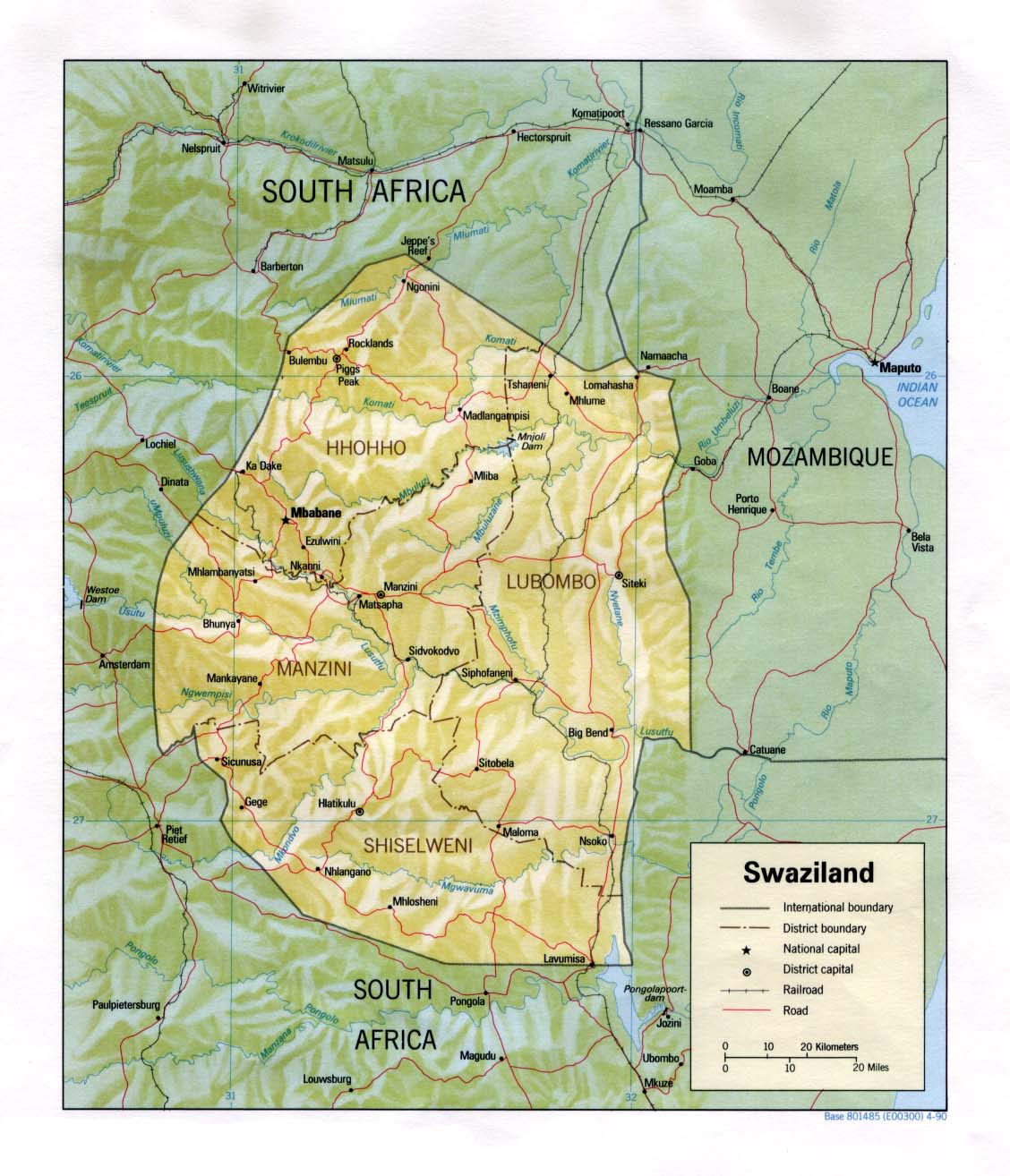
| + | * [http://www.lib.utexas.edu/maps/africa/swaziland_rel90.jpg Swaziland] (Shaded Relief) 1990 (185K) and [africa/swaziland_rel_1990.pdf pdf format] (192K) | ||
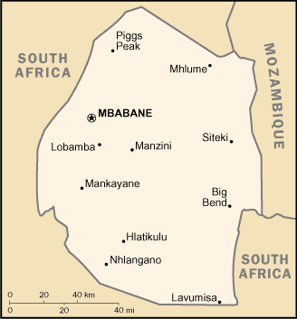
| + | * [http://www.lib.utexas.edu/maps/cia05/swaziland_sm05.gif Swaziland] (Small Map) 2005 (8K) | ||
| + | * [http://www.lib.utexas.edu/maps/tanzania.html Tanzania Maps] | ||
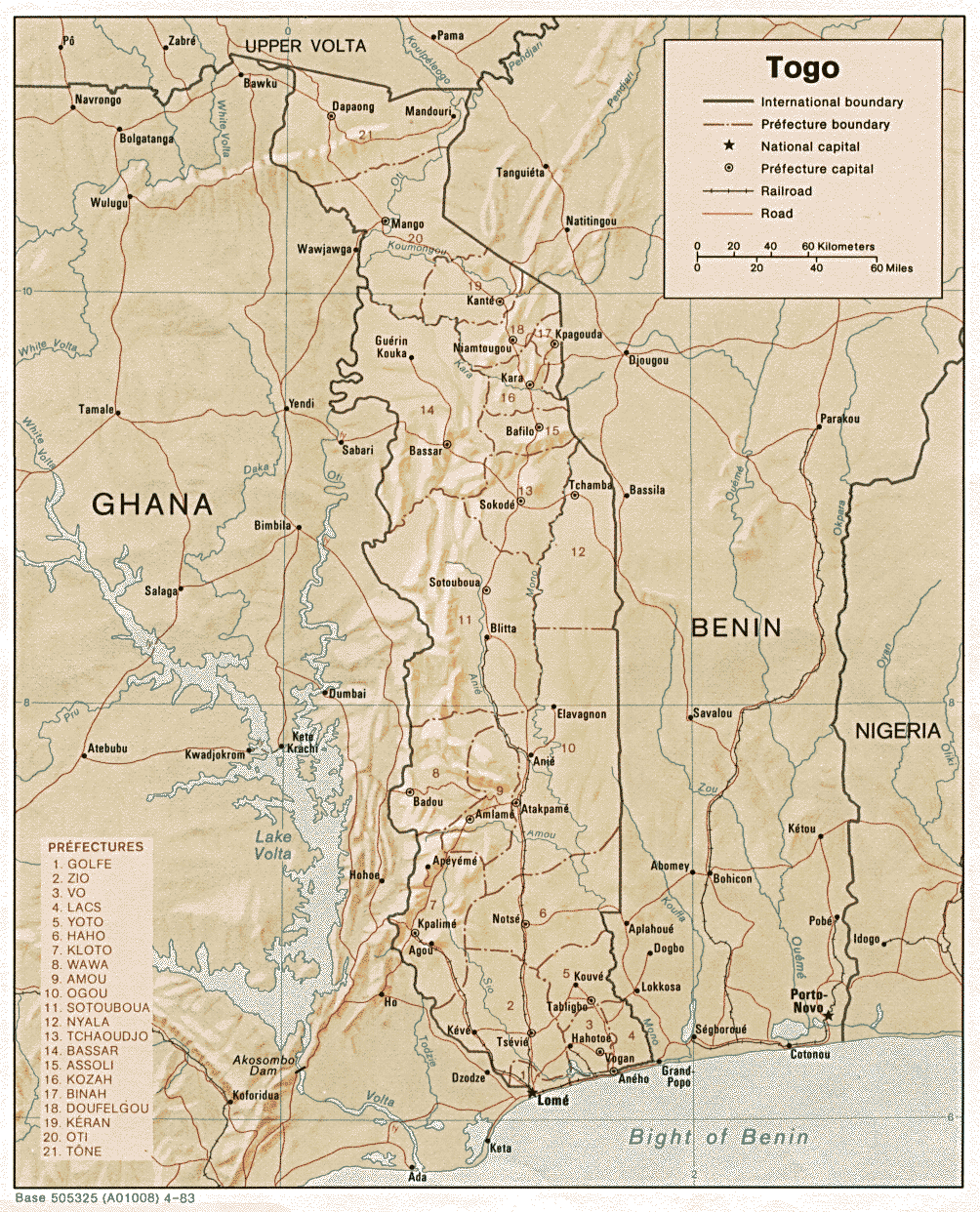
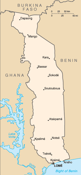
| + | * [http://www.lib.utexas.edu/maps/africa/togo.gif Togo] (Shaded Relief) 1983 (369K) and [africa/togo_rel_1983.pdf pdf format] (398K) | ||
| + | * [http://www.lib.utexas.edu/maps/cia05/togo_sm05.gif Togo] (Small Map) 2005 (16K) | ||
| + | * [http://www.lib.utexas.edu/maps/tunisia.html Tunisia Maps] | ||
| + | * [http://www.lib.utexas.edu/maps/uganda.html Uganda Maps] | ||
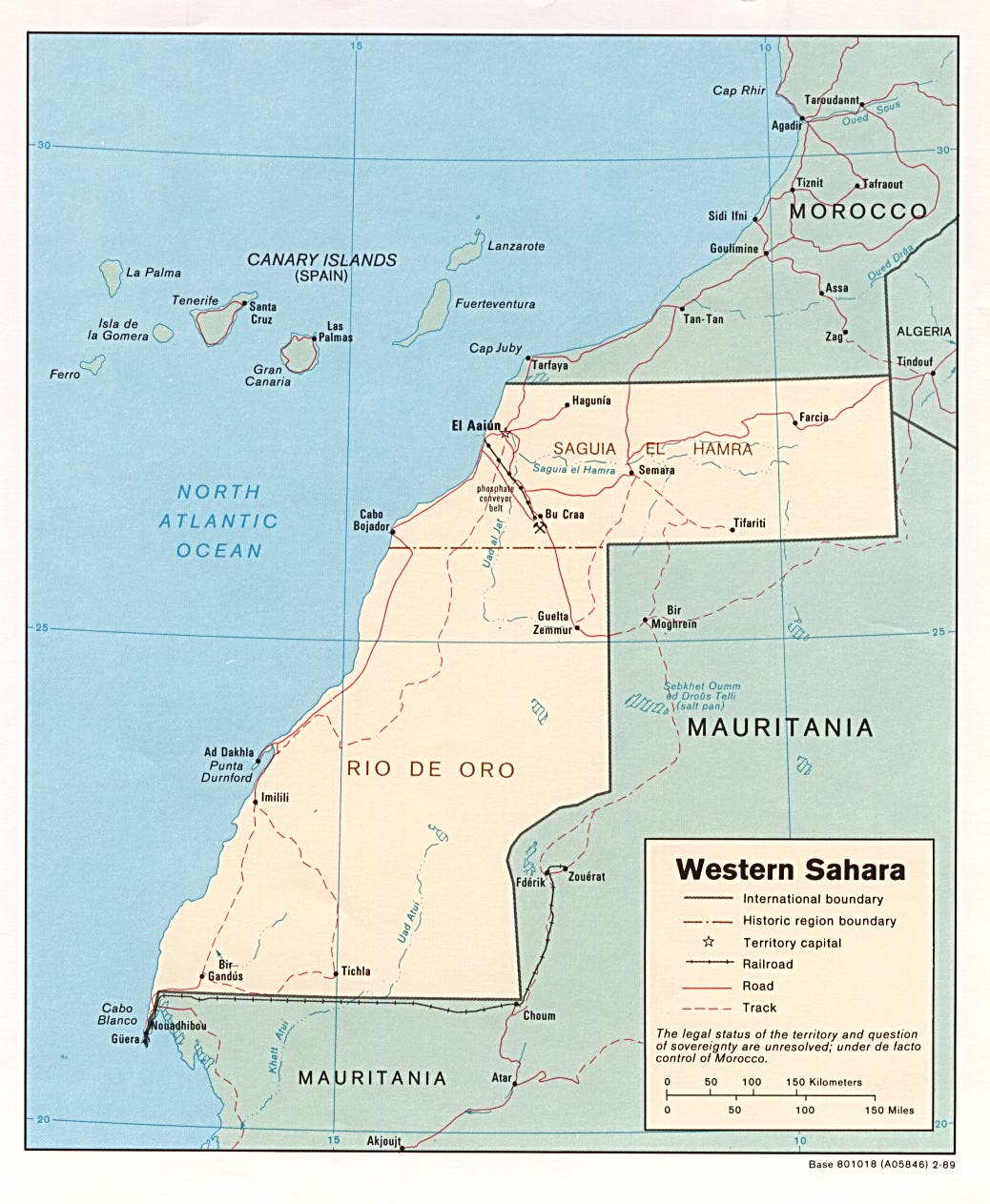
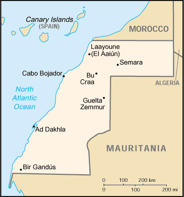
| + | * [http://www.lib.utexas.edu/maps/africa/westernsahara.jpg Western Sahara] (Political) 1989 (157K) and [africa/western_sahara_pol_1989.pdf pdf format] (180K) | ||
| + | * [http://www.lib.utexas.edu/maps/africa/western_sahara_rel_1989.jpg Western Sahara] (Shaded Relief) 1989 (135K) and [africa/western_sahara_rel_1989.pdf pdf format] (141K) | ||
| + | * [http://www.lib.utexas.edu/maps/cia05/western_sahara_sm05.gif Western Sahara] (Small Map) 2005 (10K) | ||
| + | * [http://www.lib.utexas.edu/maps/zaire.html Zaire Maps (Democratic Republic of the Congo)] | ||
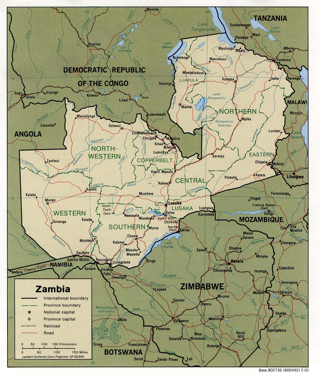
| + | * [http://www.lib.utexas.edu/maps/africa/zambia_pol01.jpg Zambia] (Political) 2001 (275K) and [africa/zambia_pol01.pdf pdf format] (286K) | ||
| + | * [http://www.lib.utexas.edu/maps/africa/zambia.gif Zambia] (Political) 1988 (257K) and [africa/zambia_pol_1988.pdf pdf format] (280K) | ||
| + | * [http://www.lib.utexas.edu/maps/africa/zambia_rel01.jpg Zambia] (Shaded Relief) 2001 (314K) and [africa/zambia_rel01.pdf pdf format] (321K) | ||
| + | * [http://www.lib.utexas.edu/maps/africa/zambia_rel_1988.jpg Zambia] (Shaded Relief) 1988 (255K) and [africa/zambia_rel_1988.pdf pdf format] (233K) | ||
| + | * [http://www.lib.utexas.edu/maps/cia05/zambia_sm05.gif Zambia] (Small Map) 2005 (14K) | ||
| + | * [http://www.lib.utexas.edu/maps/zimbabwe.html Zimbabwe Maps] | ||
| + | |||
| + | [[Kategorie:Geodaten]] | ||
| + | [[Kategorie:Afrika]] | ||
Aktuelle Version vom 25. September 2006, 14:56 Uhr
Afrika
- Africa Landsat 742
- Thumbnail
- Torrent-Download, 6.14 GB
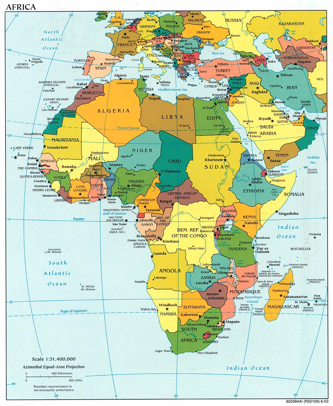
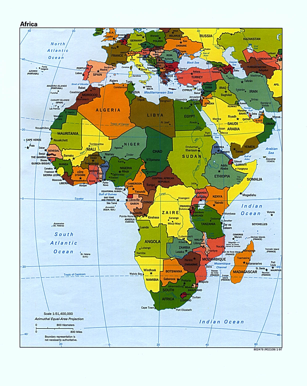
- Africa (Political) 2003 (302K) and * pdf format (272K)
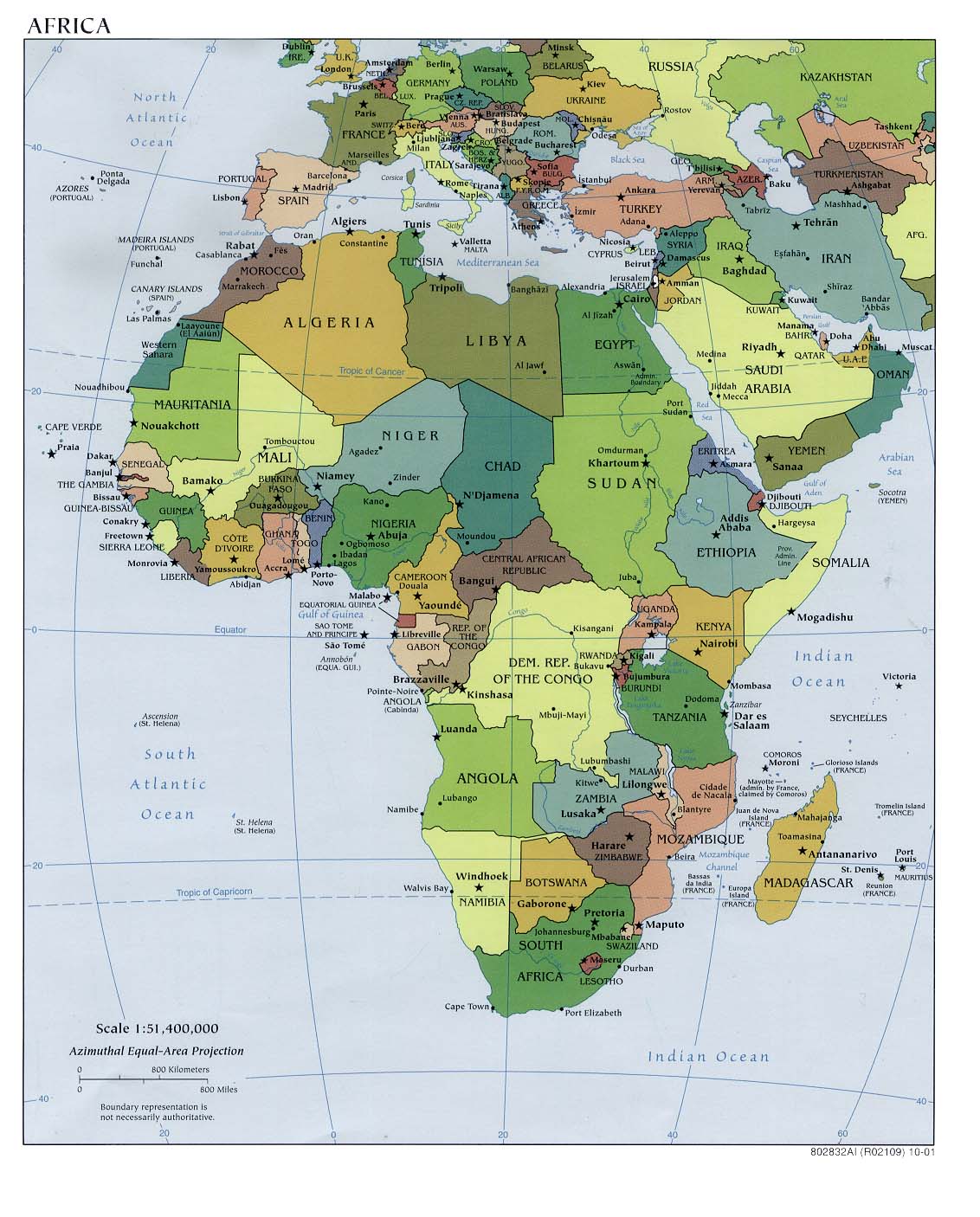
- Africa (Political) 2001 (232K) and [africa/africa_pol_2001.pdf pdf format] (234K)
- Africa (Political) 2000 (249K) and [africa/africa_pol_2000.pdf pdf format] (257K)
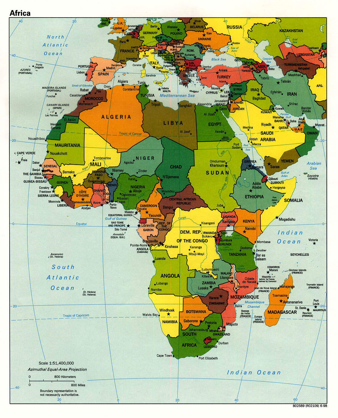
- Africa (Political) 1998 (452K) and [africa/africa_pol_1998.pdf pdf format] (390K)
- Africa (Political) June 1997 (349K) and [africa/africa_pol_1997.pdf pdf format] (338K)
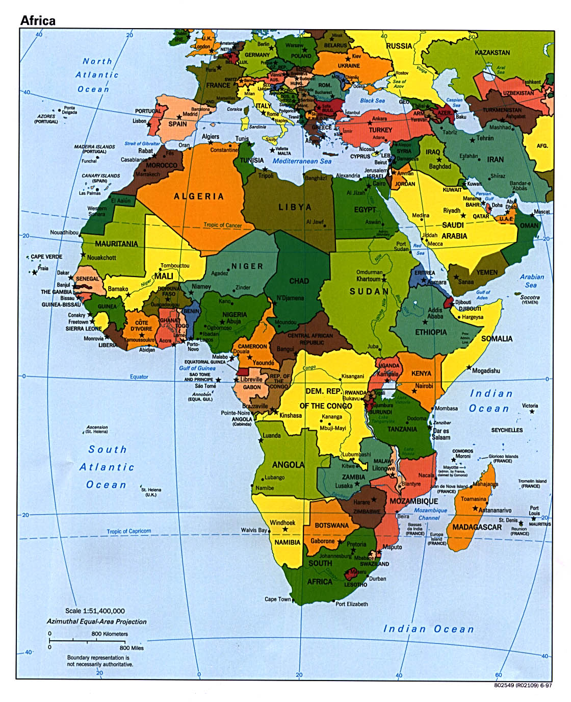
- Africa (Political) January 1997 (366K) and [africa/africa_pol97.pdf pdf format] (1.2MB)
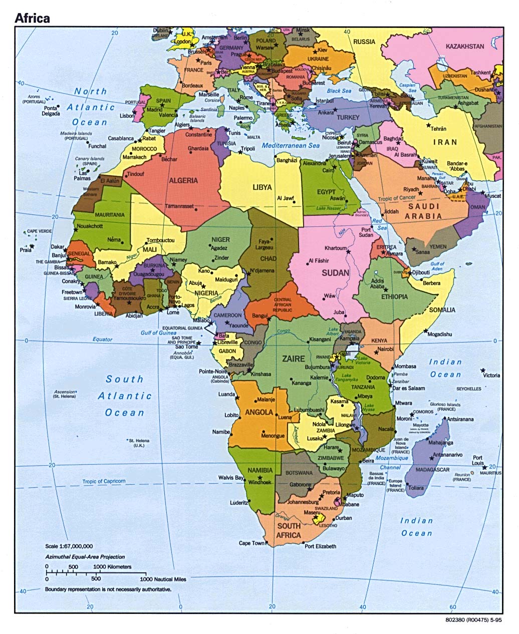
- Africa (Political) 1995 (265K) and [africa/africa_pol_1995.pdf pdf format] (262K)
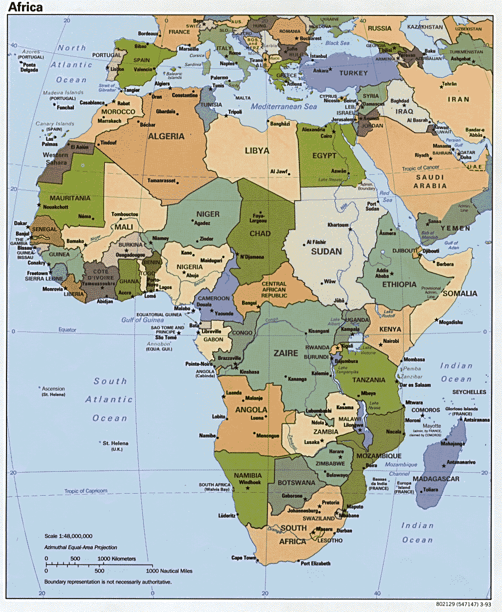
- Africa (Political) 1993 (274K) and [africa/africa_pol_1993.pdf pdf format] (282K)
- Africa (Reference Map) 2005 (472K) [pdf format]
- Africa (Reference Map) 2003 (392K) and [africa/africa_ref_2003.pdf pdf format] (459K)
- Africa (Reference Map) 2002 (320K) and [africa/africa_ref02.pdf pdf format] (323K)
- Africa (Reference Map) 2001 (281K) and [africa/africa_ref01.pdf pdf format] (956K)
- Africa (Reference Map) 2000 (316K) and [africa/africa_ref00.pdf pdf format] (788K)
- Africa (Reference Map) 1999 (190K) [africa/africa_ref802641_99.jpg larger jpeg image] (306K) and [africa/africa_ref802641_1999.pdf pdf format] (582K)
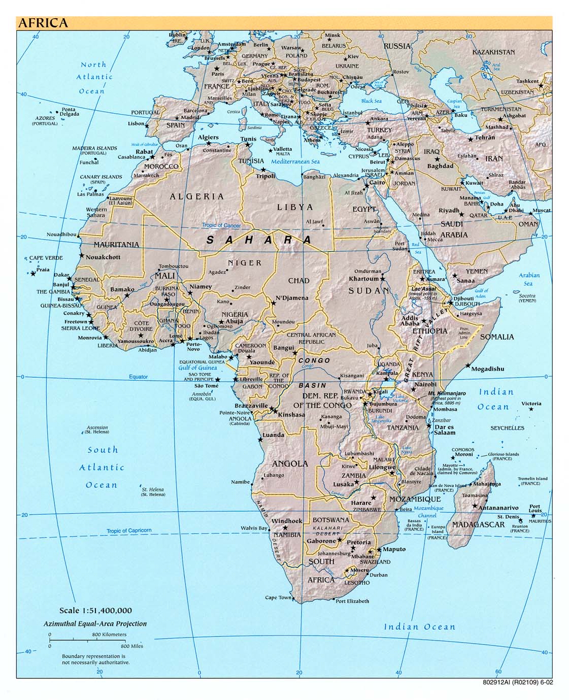
- Africa Historical Maps
- Africa, Islam in 1987 (195K) and [africa/africa_islam_1987.pdf pdf format] (198K)
- Africa Natural Vegetation 1986 (260K) and [africa/africa_veg_1986.pdf pdf format] (234K)
- Africa Population Density 1979 (232K) and [africa/africa_pop_1979.pdf pdf format] (235K)
- Algeria Maps
- Angola Maps
- Benin Maps
- Botswana Maps
- Burkina Faso Maps
- Burundi Maps
- Cameroon Maps
- Cape Verde Maps
- Central Africa (Reference Map) 1999 (113K) [africa/africa_cen_ref802642_99.jpg larger jpeg image] (510K)
- Central Africa (Reference Map) 2001 (423K) and [africa/centralafrica_ref01.pdf pdf format] (1.4MB)
- Central Africa (Reference Map) 2000 (845K) [pdf format]
- Central Africa (Reference Map) 1999 (630K) [pdf format]
- Central Africa (Political) 1997 (527K)
- Central African Republic Maps
- Chad Maps
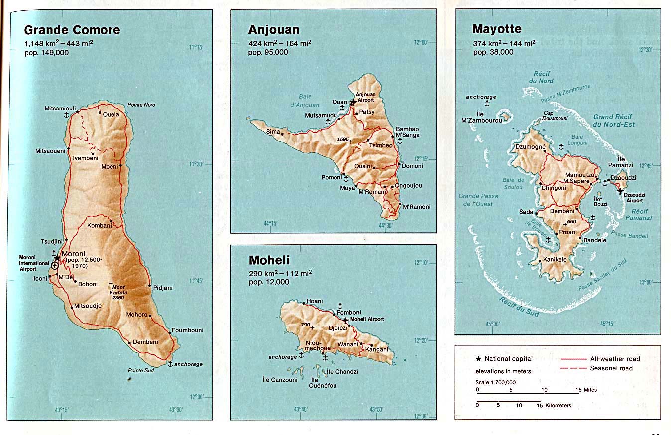
- Comoros (Political) 1991 (212K) and [africa/comoros_pol_1991.pdf pdf format] (224K)
- Comoros (Shaded Relief) 1991 (119K) and [africa/comoros_rel_1991.pdf pdf format] (126K)
- Comoros (Small Map) 2005 (7K)
- Comoros (Grande Comore, Anjouan, Moheli, Mayotte) From The Indian Ocean Atlas, 1976 (198K)
- Congo Maps, Democratic Republic of the (former Zaire)
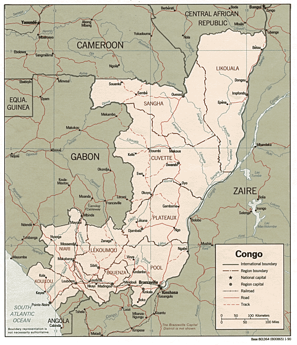
- Congo, Republic of the (Political) 1990 (310K) and [africa/congo_pol_1990.pdf pdf format] (337K)
- Congo, Republic of the (Shaded Relief) 1990 (265K) and [africa/congo_rel_1990.pdf pdf format] (274K)
- Congo, Republic of the (Small Map) 2005 (13K)
- Cote d'Ivoire Maps
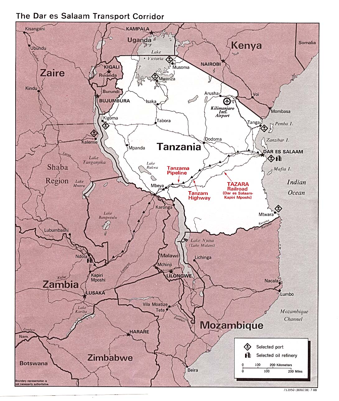
- Dar es Salaam Transport Corridor 1988 (402K)
- Djibouti Maps
- Egypt Maps
- Equatorial Guinea Maps
- Eritrea Maps
- Ethiopia Maps
- Gabon Maps
- Gambia Maps
- Ghana Maps
- Guinea Maps
- Guinea Bissau (Political) 1993 (220K) and [africa/guinea_bissau_pol_1993.pdf pdf format] (235K)
- Guinea Bissau (Shaded Relief) 1993 (229K) and [africa/guinea_bissau_rel_1993.pdf pdf format] (236K)
- Guinea Bissau (Small Map) 2005 (12K)
- Horn of Africa (Shaded Relief) 1992 (218K)
- Horn of Africa (Shaded Relief) 1972 (420K)
- Horn of Africa Ethnic Groups 1980 (213K)
- Ivory Coast (Cote d'Ivoire) Maps
- Kenya Maps
- Lesotho (Political) 1990 (341K) and [africa/lesotho_pol90.pdf pdf format] (244K)
- Lesotho (Shaded Relief) 1990 (341K) and [africa/lesotho.pdf pdf format] (356K)
- Lesotho (Small Map) 2005 (7K)
- Liberia Maps
- Libya Maps
- Madagascar Maps
- Malawi (Political) 1985 (172K) and [africa/malawi_pol_1985.pdf pdf format] (178K)
- Malawi (Shaded Relief) 1985 (197K) and [africa/malawi_rel_1985.pdf pdf format] (200K)
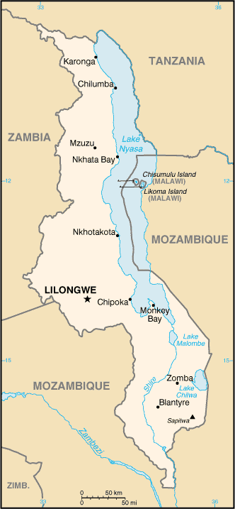
- Malawi (Small Map) 2005 (19K)
- Mali Maps
- Mauritania Maps
- Mauritius Maps
- Morocco Maps
- Mozambique Maps
- Namibia Maps
- Niger Maps
- Nigeria Maps
- Northern Africa and the Middle East (Political) 1995 (207K)
- Rwanda (Small Map) 2005 (11K)
- Rwanda and Burundi (Political) 1996 (254K) and [africa/rwanda_pol_1996.pdf pdf format] (238K)
- Rwanda and Burundi (Political) 1975 (311K) and [africa/rwanda_and_burundi_pol_1975.pdf pdf format] (343K)
- Rwanda and Burundi (Shaded Relief) 1996 (293K) and [africa/rwanda_rel_1996.pdf pdf format] (271K)
- Rwanda and Burundi (Shaded Relief) 1975 (288K)
- Sao Tome Portion of Libreville sheet. Topographic Map NA 32, Series 1301.Original Scale 1: 1,000,000. Printed by U.S. Army Map Service, Corps of Engineers, 1963 (81K)
- Sao Tome and Principe (Political) U.S. Department of State 1991 (71K)
- Sao Tome and Principe (Small Map) 2005 (6K)
- Senegal (Political) 1989 (289K) and [africa/senegal_pol_1989.pdf pdf format] (305K)
- Senegal (Shaded Relief) 1989 (264K) and [africa/senegal_rel_1989.pdf pdf format] (272K)
- Senegal (Small Map) 2005 (12K)
- Seychelles Maps
- Sierra Leone Maps
- Somalia Maps
- South Africa Maps
- Sudan Maps
- Swaziland (Political) 1990 (327K) and [africa/swaziland_pol_1990.pdf pdf format] (346K)
- Swaziland (Shaded Relief) 1990 (185K) and [africa/swaziland_rel_1990.pdf pdf format] (192K)
- Swaziland (Small Map) 2005 (8K)
- Tanzania Maps
- Togo (Shaded Relief) 1983 (369K) and [africa/togo_rel_1983.pdf pdf format] (398K)
- Togo (Small Map) 2005 (16K)
- Tunisia Maps
- Uganda Maps
- Western Sahara (Political) 1989 (157K) and [africa/western_sahara_pol_1989.pdf pdf format] (180K)
- Western Sahara (Shaded Relief) 1989 (135K) and [africa/western_sahara_rel_1989.pdf pdf format] (141K)
- Western Sahara (Small Map) 2005 (10K)
- Zaire Maps (Democratic Republic of the Congo)
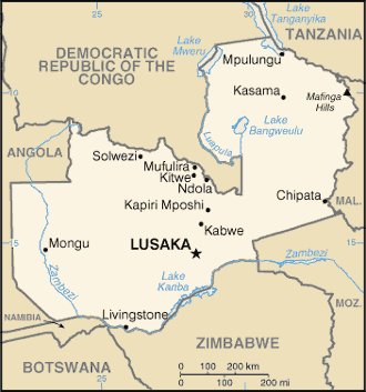
- Zambia (Political) 2001 (275K) and [africa/zambia_pol01.pdf pdf format] (286K)
- Zambia (Political) 1988 (257K) and [africa/zambia_pol_1988.pdf pdf format] (280K)
- Zambia (Shaded Relief) 2001 (314K) and [africa/zambia_rel01.pdf pdf format] (321K)
- Zambia (Shaded Relief) 1988 (255K) and [africa/zambia_rel_1988.pdf pdf format] (233K)
- Zambia (Small Map) 2005 (14K)
- Zimbabwe Maps